| State | Habitat Potential |
|---|---|
| Alabama | 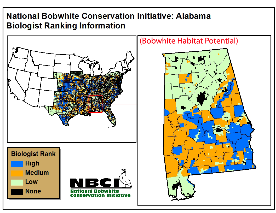 |
| Arkansas | 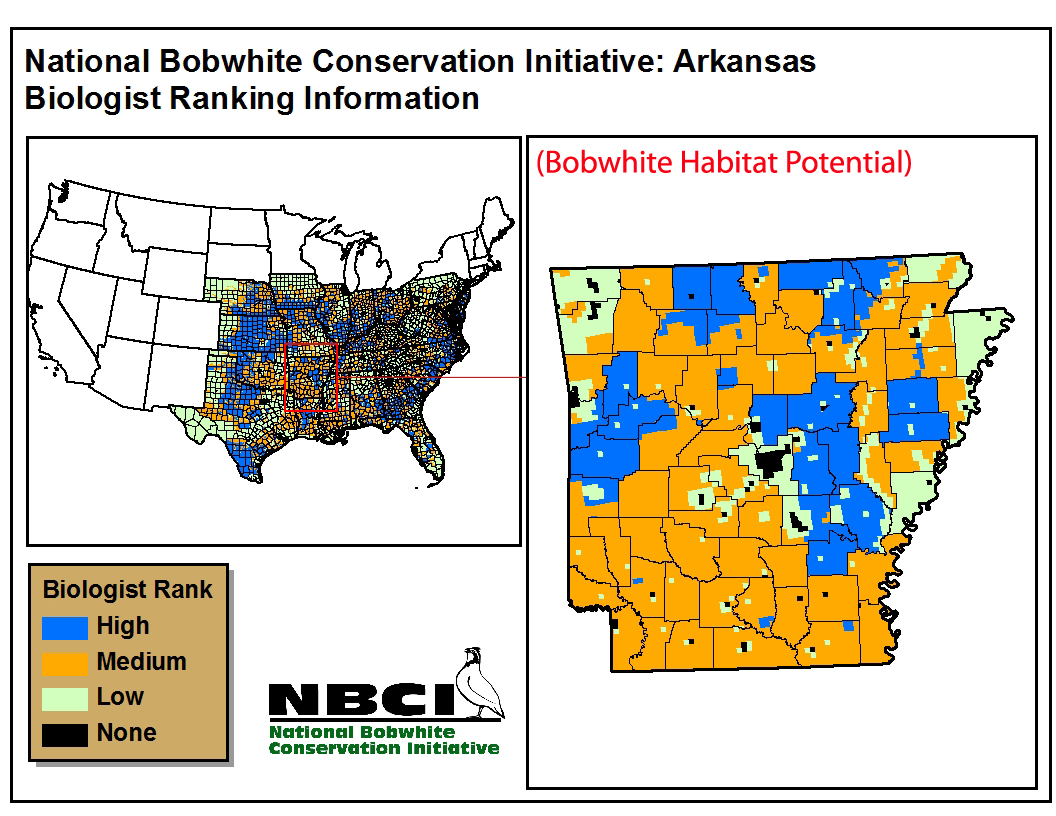 |
| Delaware | 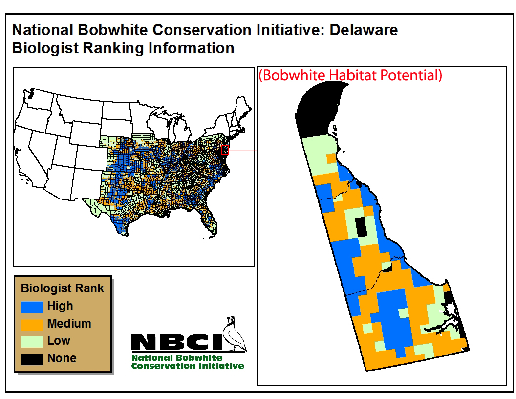 |
| Florida | 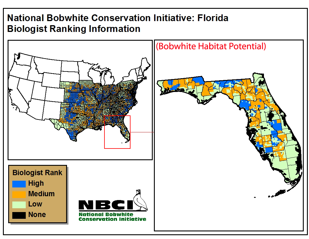 |
| Georgia | 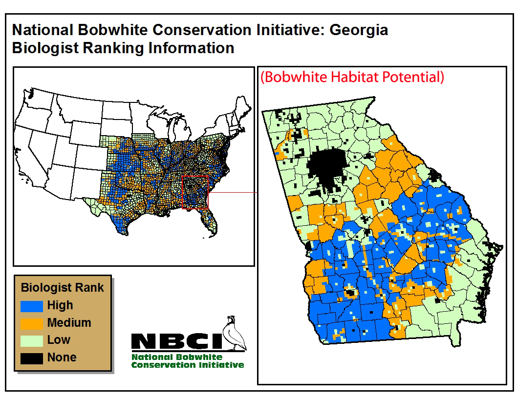 |
| Illinois | 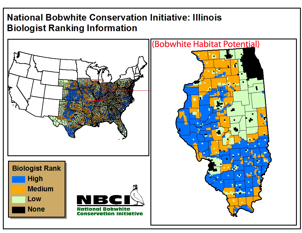 |
| Indiana | 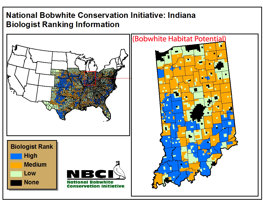 |
| Iowa | 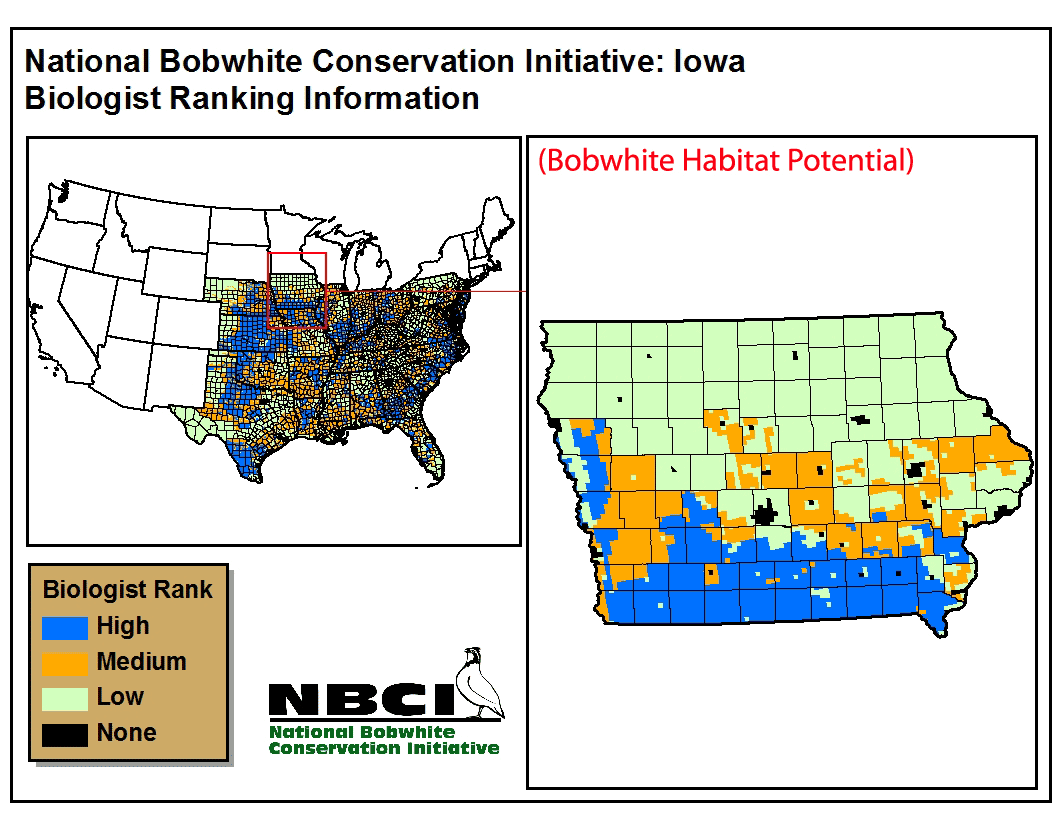 |
| Kansas | 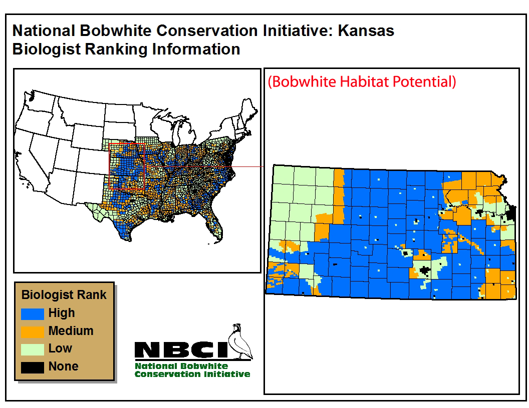 |
| Kentucky | 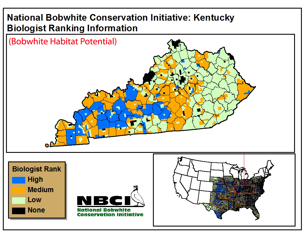 |
| Louisiana | 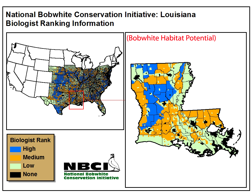 |
| Maryland | 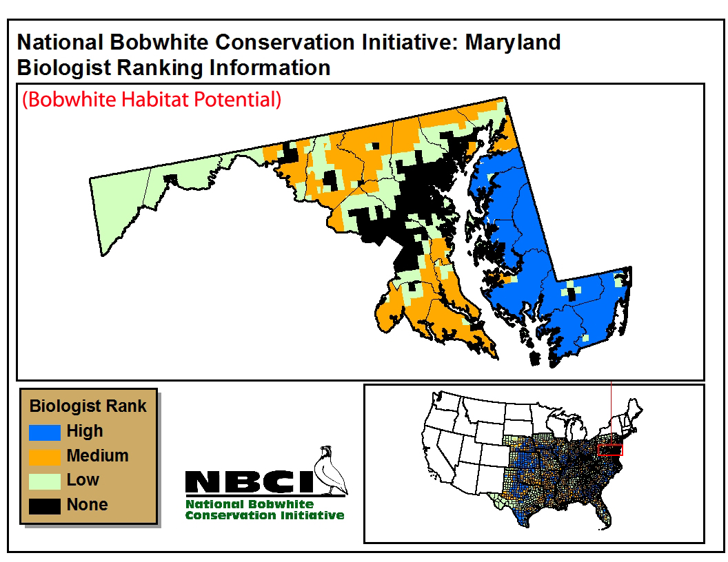 |
| Mississippi |  |
| Missouri | 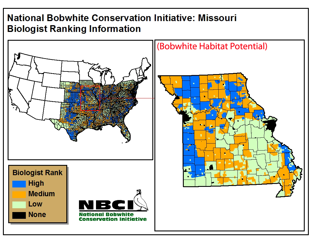 |
| Nebraska | 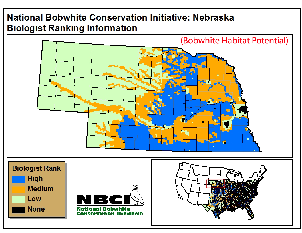 |
| New Jersey | 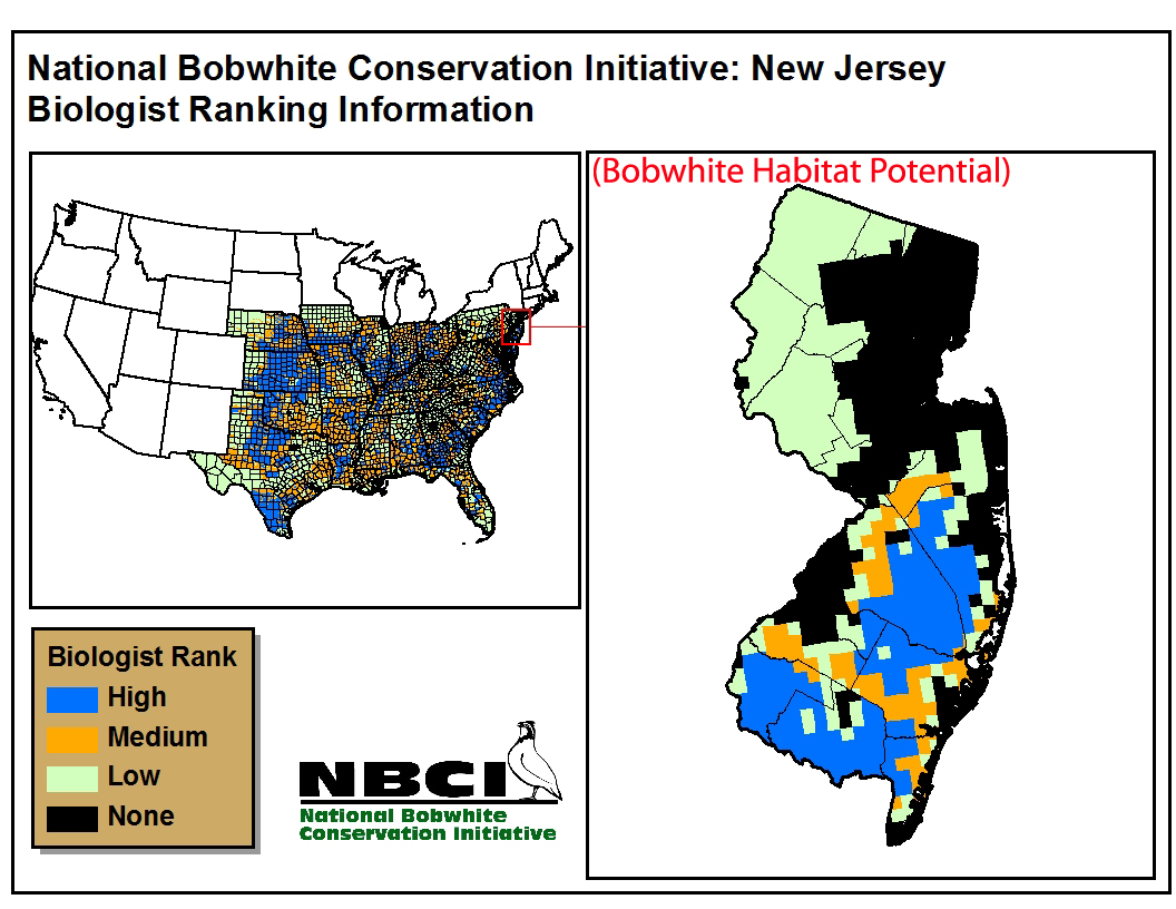 |
| North Carolina | 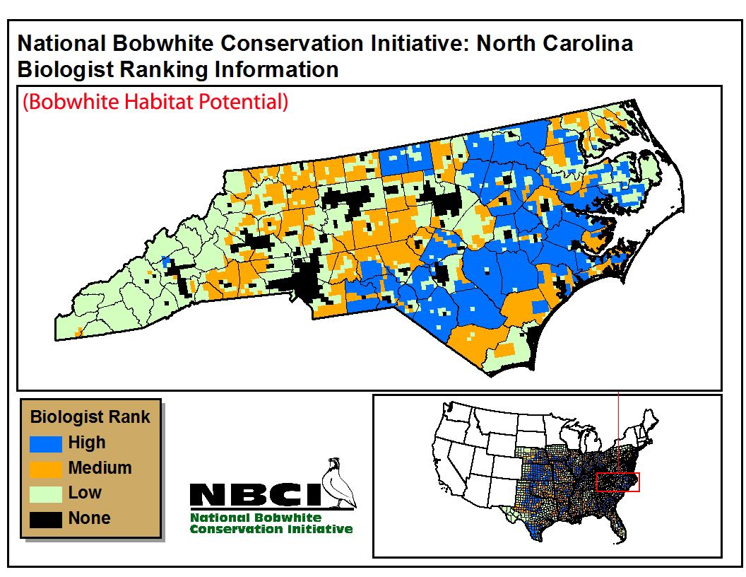 |
| Ohio | 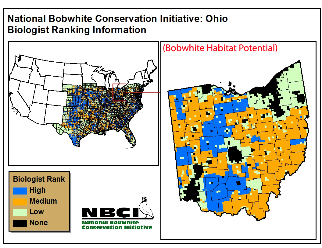 |
| Oklahoma | 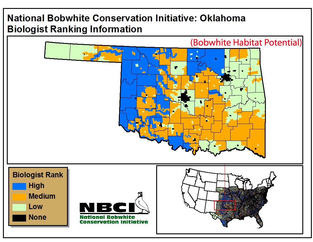 |
| Pennsylvania | 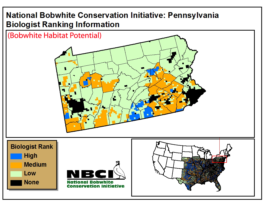 |
| South Carolina | 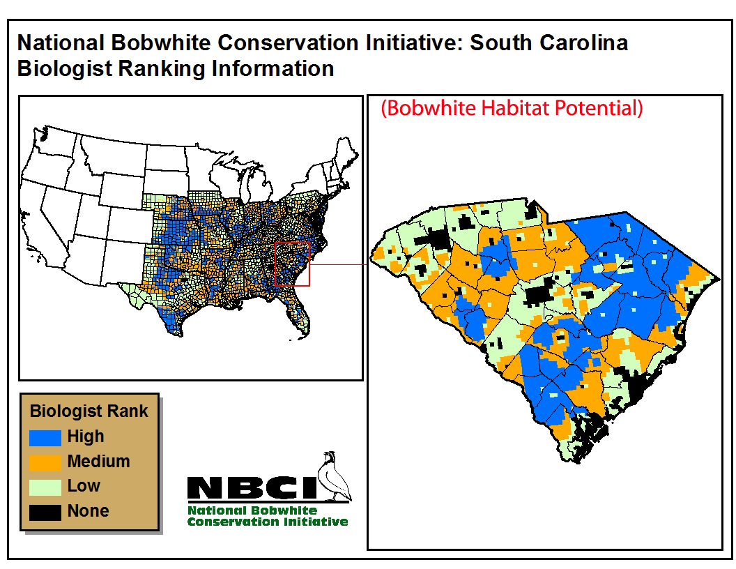 |
| Tennessee | 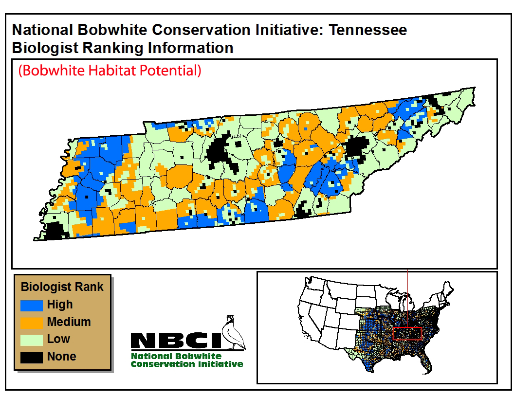 |
| Texas | 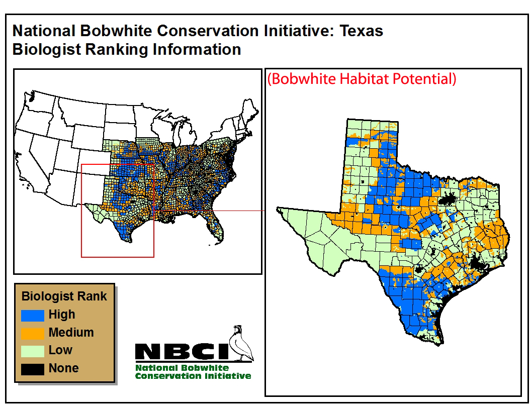 |
| Virginia | 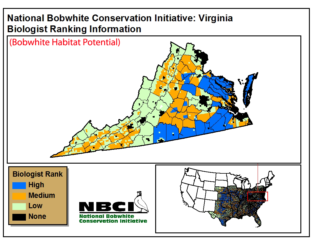 |
| West Virginia | 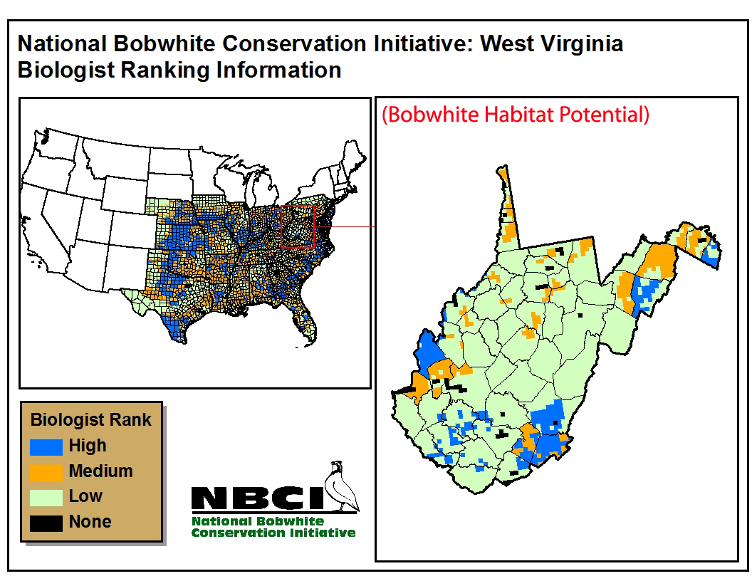 |